In 2025, we will mark the 280th anniversary of the Battle of Prestonpans. As we head towards this milestone, our Beyond the Battle project aims to research, map and present a comprehensive snapshot of the community which lived on the battlefield in 1745 – and how that community and its landscape have evolved in the 280 years since.
BEYOND THE BATTLE: AN INTRODUCTION
Our aim is to create an unprecedented understanding of the landscape in which the Battle of Prestonpans was fought – and the people who lived in it.
Our research will be guided by a series of core questions:
- Who lived on the battlefield in September 1745, and what did they do?
- What was life like for the people who lived here?
- How did the conflict in 1745 affect the lives of the residents?
- Do any descendents of these residents still live in the community?
- What did our community look like in 1745 – and do any of the buildings, roads and features remain?
- What are the milestones of change on the landscape and community in the last 280 years.
The project will be run from the Battle of Prestonpans Museum, where we will be holding a series of events as the work progresses – including opportunities for you to get involved.
The project will lead to, amongst other things:
- A special exhibition at the Battle of Prestonpans Museum, as part of the 280th anniversary of the battle
- FactFiles available at our museum and here on the website, providing detailed information on the people and places which made up the battlefield community in 1745
- An interactive digital map of the battlefield area, highlighting the main features and revealing how the landscape has evolved over time
As our project develops, we’ll be posting up progress reports here to let you know what we are investigating.
Map Regression workshops
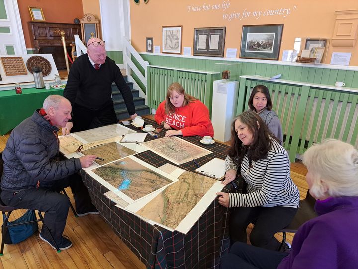
In early September we held two round-table discussion workshops focusing on a series of maps and plans of the battle which were created in 1745. For comparison, we also used several later 18th and 19th century maps of the same area, and made use of the National Library of Scotland’s amazing online map tools. The purspose of the workshops was to stimulate thought about the geographical features of the battlefield: what was recognisable to us and what was not; whether the contemporary plans were consistent in how they showed the features and settlements; whether there were any mysteries to solve, such as inconsistences, anomalies, or things which were missing.
The results of the conversations raised a number of issues which we want to look into deeper:
- Lost villages: what happened to the small hamlet near Bankton House, identifiable on some plans of the battlefield but no longer extant, and the village of Seton which was clearly more substantial in 1745 than it is today?
- The drainage ditch: was this a linear man-made feature, or was it a natural watercourse – or both! When was it dug, and when was it filled in? How does it fit into the longer history of water management on the battlefield?
- The Prestonpans windmill: a long-standing question, as a windmill features on battlefield plans but does not seem to appear in later maps. Where exactly was it, and what was it for?
- The Riggonhead Defile: how significant was the defile as a geographical feature, considering that it does not appear in any meaningful way on the plans?
- Preston House walls: we think we might have pin-pointed their lines, and that parts might still be traceable, but the interior arrangement of the gardens is very inconsistently shown in the plans and the mercat cross is never depicted.
Some of these questions might be answered by further map regression. Some of them might require a little more archival research. We’ll let you know how we get on.
In the meantime, here’s our curator Dr Arran Johnston to provide a synpotic summary of the contemporary battle plans:
Producing our own “List of Persons Concerned…”
We don’t just want to create a map of the streets and landscapes of the Prestonpans area in 1745; we want to populate it with people!
So who lived here at the time of the battle, and do the battle records help us get deeper into the community than might otherwise have been possible?
The big question is where to even start with such an exercise! Well we are going to start with some of the people we know lived here at the time.
First off, the gentlemen and local worthies: Lord Grange, MP; lords Prestongrange and Drummore; the ministers, Reverend Cunningham at Tranent and Reverend Carlyle in Prestonpans; and the Gardiner family at Bankton.
After that, the we have decided to draw upon the List of Persons Concerned in the Rebellion. This database, compiled county-by-county in 1746, records all those accused of rebellious actions in the course of the last Jacobite rising. It lists names, place of residence, occupation, and alleged misdemeanors. This list contains a number of men who lived in the Prestonpans area who allegedly helped, sympathised, or event fought with the Jacobites – and that inadvertently provides us with a snapshot of the community. So we are studying this list, looking at the occupations listed to see if there are any trends, and cross-referencing the people listed with other records (such as the churchs’ burial lists) to see if we can grow their families and uncover their stories.
Some fascinating results have been emerging from this study, including hints at widely differing motivations for joining the Jacobite army and evidence of some perhaps unsurprising results of soldiers mixing with the local townsfolk.
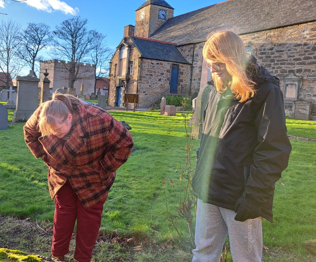
Our volunteers are also delving into kirk session records and the funerary monuments in our churchyards, to continue building a “who’s who” of the battlefield community – our own List of Persons Concerned!
Interesting walls!
As part of our research on the physical landscape of the battlefield, we are trying to trace some of the old boundary lines, roads and walls – especially those around the former Preston House site – in order to pin down locations and landmarks.
But these aren’t the only walls we are interested in!
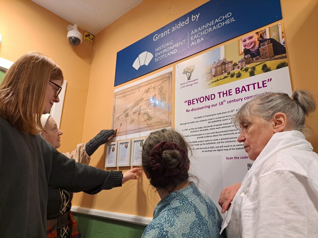
We have also dedicated a wall in our museum’s reception area at Prestonpans Town Hall, to showcase some of the information we are gathering during the research project. Here we are posting some details of local residents of the battlefield area, and a handy QR link for visitors to find this page and the ongoing work it reports. We are sure it will become a great conversation starter with both locals and visitors alike!
The Life and Death of Colonel Gardiner
One of the battlefield’s most famous regiments was Colonel James Gardiner, who lived with his family at Bankton House on the southern edge of Preston village.
Gardiner was a career soldier, with a long history of service stretching back through the 1715 Rising to the great campaigns of Marlborough. At the Battle of Prestonpans, he was mortally wounded after the rout of his regiment – the 13th Dragoons – and died a few hours later in Tranent manse. In January 2025, on Gardiner’s birthday, we held an event at the museum to tell the story of his life whilst highlighting some of the objects which he have on display relating to him.
During the research for the presentation, we found a possible lead to a forgotten portrait of Gardiner – we will keep investigating until we can find out more!
Here is a slightly abridged online version of our talk The Life and Death of Colonel Gardiner:
The Erskines of Preston House
One of the most important landmarks of the battlefield was Preston House, the park walls of which helped to trap much of the redcoat infantry when they tried to escape from the fighting.
Preston House no longer stands, but evidence of where it was and what it looked like can still be found. Not only that, but the arrangement of the estate has helped to influence the layout of later street patterns, and the fact that the house was later converted into a school ensured that even after much of the estate was sold of the house’s grounds came into public ownership and became the ideal locations for the primary school, community centre, medical surgery and swimming baths.
At the time of the battle, Preston House was owned by James Erskine, Lord Grange, whose character appears to have been a fascinating contradiction of Presbyterian piety and drunken debauchery, with a good measure of political intrigue thrown in. Erskine’s destructive marriage to Rachel Chiesley, and his terrible treatment of her in later life, create a remarkable story which played out against the backdrop of the battlefield’s most impressive mansion.
We presented our research into Lord Grange and his property in a presentation held at the museum. Here again is a slightly abridged version created for our online audiences:
“Beyond the Battle” is supported by Historic Environment Scotland.